File:AbyssalColony.elevation.png
Jump to navigation
Jump to search

Size of this preview: 691 × 599 pixels. Other resolution: 1,764 × 1,530 pixels.
Original file (1,764 × 1,530 pixels, file size: 1.25 MB, MIME type: image/png)
Summary[edit]
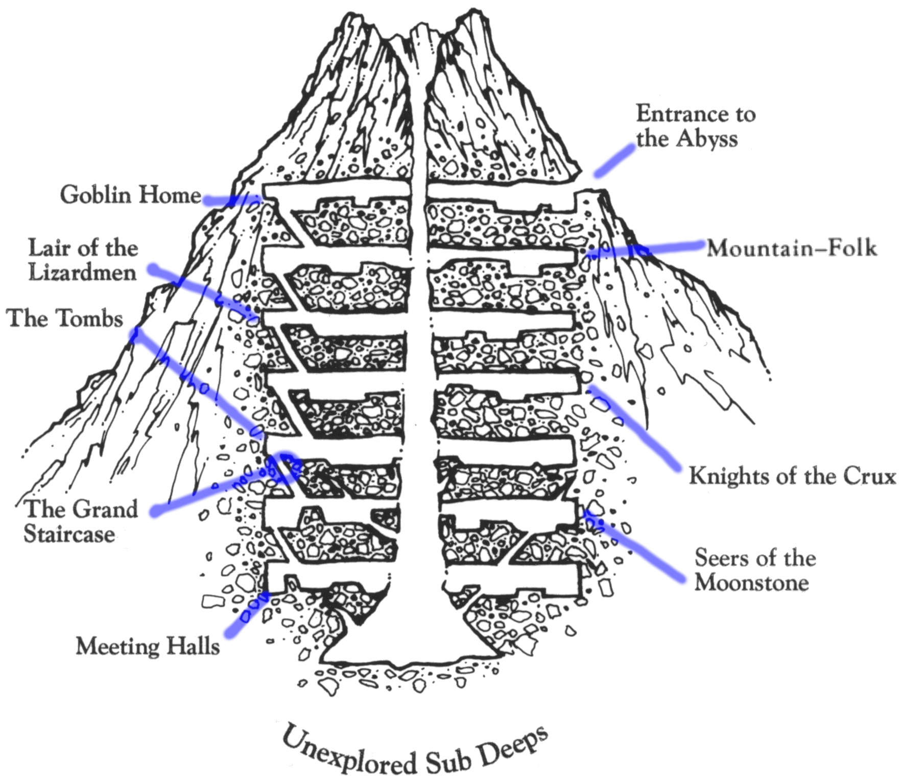
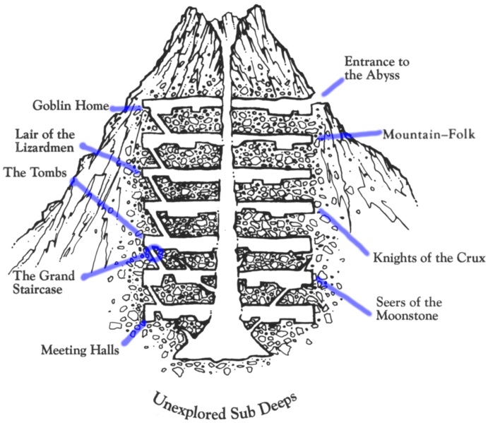
This is an elevation map of the Great Stygian Abyss Colony. I (User:Sir Robin) couldn't find a good clean version of this online, as many scans of the physical paper map have creases in them, so I created this file as a compisite of several files I stitched together and cleaned up.
File history
Click on a date/time to view the file as it appeared at that time.
| Date/Time | Thumbnail | Dimensions | User | Comment | |
|---|---|---|---|---|---|
| current | 10:15, 3 March 2025 | | 1,764 × 1,530 (1.25 MB) | Sir Robin (talk | contribs) | This is an elevation map of the Great Stygian Abyss Colony. I (User:Sir Robin) couldn't find a good clean version of this online, as many scans of the physical paper map have creases in them, so I created this file as a compisite of several files I stitched together and cleaned up. Category:Map Files |
You cannot overwrite this file.
File usage
The following page uses this file: